Multan
Multan is a city in Punjab, Pakistan, on the bank of the Chenab River. Multan is Pakistan's seventh largest city as per the 2017 census, and the major cultural, religious and economic centre of southern Punjab.
Multan is one of the oldest continuously inhabited cities in Asia, with a history stretching deep into antiquity. The ancient city was the site of the renowned Multan Sun Temple, and was besieged by Alexander the Great during the Mallian Campaign. A historic cultural centre of the wider Punjab, it was conquered by the Ummayad military commander Muhammad bin Qasim. The city later became independent as the capital of the Emirate of Multan in 855 A.D., before subsequently coming under the rule of empires such as the Ghaznavids, the Ghurids and the Mamluks. In 1445, it became capital of the Langah Sultanate. In 1526, it was conquered by the Mughal Empire. Multan Subah would become one of the largest provinces of the Mughal Empire when it was created by administrative reforms of Emperor Akbar. Afterwards, Multan became part of the Durrani and Sikh empires successively. In 1848, it was conquered by the British Empire and became part of British Punjab. After independence, it became part of Pakistan.
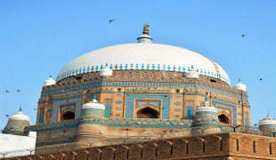
Multan was one of the most important trading centres of the medieval Islamic Indian subcontinent, and attracted a multitude of Sufi mystics in the 11th and 12th centuries, earning the city the sobriquet "City of Saints." The city, along with the nearby city of Uch, is renowned for its large number of Sufi shrines dating from that era.
The origin of Multan's name is unclear. An ancient known name of the city was Malli-istan; Malli was the name of a tribe that inhabited the region and city. Some have suggested the name derives from the Old Persian word mulastāna, 'frontier land', while others have ascribed its origin to the Sanskrit word mūlasthāna, which may be derived from the Hindu deity worshipped at the Multan Sun Temple. Hukm Chand in the 19th century suggested that the city was named after an ancient Hindu tribe called Malli or Mulu.
Multan is one of the oldest continuously inhabited cities in Asia, with a history stretching deep into antiquity. The ancient city was the site of the renowned Multan Sun Temple, and was besieged by Alexander the Great during the Mallian Campaign. A historic cultural centre of the wider Punjab, it was conquered by the Ummayad military commander Muhammad bin Qasim. The city later became independent as the capital of the Emirate of Multan in 855 A.D., before subsequently coming under the rule of empires such as the Ghaznavids, the Ghurids and the Mamluks. In 1445, it became capital of the Langah Sultanate. In 1526, it was conquered by the Mughal Empire. Multan Subah would become one of the largest provinces of the Mughal Empire when it was created by administrative reforms of Emperor Akbar. Afterwards, Multan became part of the Durrani and Sikh empires successively. In 1848, it was conquered by the British Empire and became part of British Punjab. After independence, it became part of Pakistan.
Multan was one of the most important trading centres of the medieval Islamic Indian subcontinent, and attracted a multitude of Sufi mystics in the 11th and 12th centuries, earning the city the sobriquet "City of Saints." The city, along with the nearby city of Uch, is renowned for its large number of Sufi shrines dating from that era.
The origin of Multan's name is unclear. An ancient known name of the city was Malli-istan; Malli was the name of a tribe that inhabited the region and city. Some have suggested the name derives from the Old Persian word mulastāna, 'frontier land', while others have ascribed its origin to the Sanskrit word mūlasthāna, which may be derived from the Hindu deity worshipped at the Multan Sun Temple. Hukm Chand in the 19th century suggested that the city was named after an ancient Hindu tribe called Malli or Mulu.
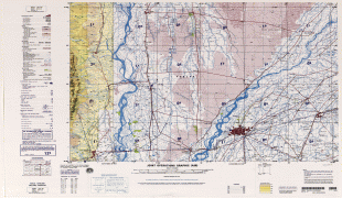
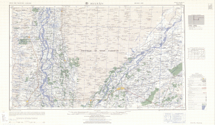
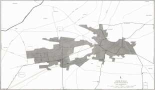
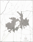
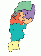
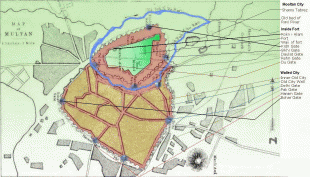
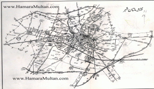
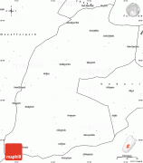
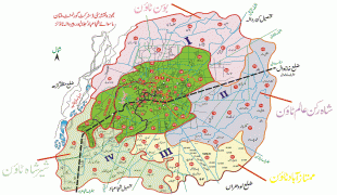
Map - Multan
Map


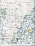
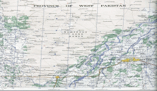

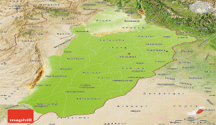
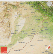
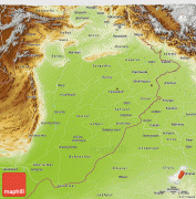
Country - Pakistan
 |
 |
| Flag of Pakistan | |
Pakistan is the site of several ancient cultures, including the 8,500-year-old Neolithic site of Mehrgarh in Balochistan, the Indus Valley civilisation of the Bronze Age, the most extensive of the civilisations of the Afro-Eurasia, and the ancient Gandhara civilization. The region that comprises the modern state of Pakistan was the realm of multiple empires and dynasties, including the Achaemenid; briefly that of Alexander the Great; the Seleucid, the Maurya, the Kushan, the Gupta; the Umayyad Caliphate in its southern regions, the Hindu Shahis, the Ghaznavids, the Delhi Sultanate, the Mughals, the Durranis, the Omani Empire, the Sikh Empire, British East India Company rule, and most recently, the British Indian Empire from 1858 to 1947.
Currency / Language
| ISO | Currency | Symbol | Significant figures |
|---|---|---|---|
| PKR | Pakistani rupee | ₨ | 2 |
| ISO | Language |
|---|---|
| EN | English language |
| PA | Panjabi language |
| PS | Pashto language |
| SD | Sindhi language |
| UR | Urdu |